


 Paddle SA is the governing body of paddle sport and recreation in South Australia. It leads and supports paddling in South Australia and encourages the safe exploration of our waterways.
Paddling Trail South Australia has a range of Paddling Trails to suit different abilities.
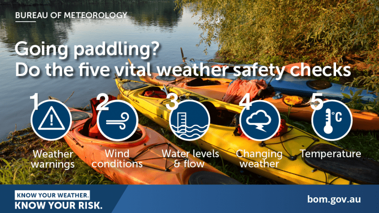
Know your ability.
Paddle SA is the governing body of paddle sport and recreation in South Australia. It leads and supports paddling in South Australia and encourages the safe exploration of our waterways.
Paddling Trail South Australia has a range of Paddling Trails to suit different abilities.
Know your ability.  If you have a smartphone or tablet you can download the free Avenza PDF Map app and have interactive paddling trail maps on hand when you need them. The app uses your device’s built-in GPS to plot your real-time location within the park onto a map. The app can be used without a network connection and without roaming charges. You can also measure area and distance, plot photos, and drop Placemark pins.
Launch Sites:![]() Castles Landing campsite. GPS: 34.3964 S; 139.6189 E.
Castles Landing campsite. GPS: 34.3964 S; 139.6189 E.![]() Alternative launch site at Swan Reach GPS: 34.5052 S; 139.5698 E
Alternative launch site at Swan Reach GPS: 34.5052 S; 139.5698 E
The trail can be tackled from Swan Reach by launching from the Reserve at the end of Swan Reach/ Stockwell Road on the western side of the river beside the Pumphouse and returning to this site to complete the loop.
Trail Points:
The trail starts at Castles Landing about 5 km along the Blanchetown/Swan Reach Road from main highway (on the eastern side of the bridge) at Blanchetown.
Camping costs here are approximately $12 per night per car, paid at the farmhouse opposite the entrance gate, where you can obtain a key to the gate. Advance bookings cannot be made. Ring before you go to ensure they are home so you can collect a key (phone 08 8540 5015).
![]() The entrance to Moorundie Creek (Point A GPS: 34.3970 S; 139.6159) is almost directly opposite the campground. It can be identified by the presence of remains of a concrete weir (see Points of Interest).
The entrance to Moorundie Creek (Point A GPS: 34.3970 S; 139.6159) is almost directly opposite the campground. It can be identified by the presence of remains of a concrete weir (see Points of Interest).
There is a difficult portage near the entrance in order to skirt two trees lying across the creek.
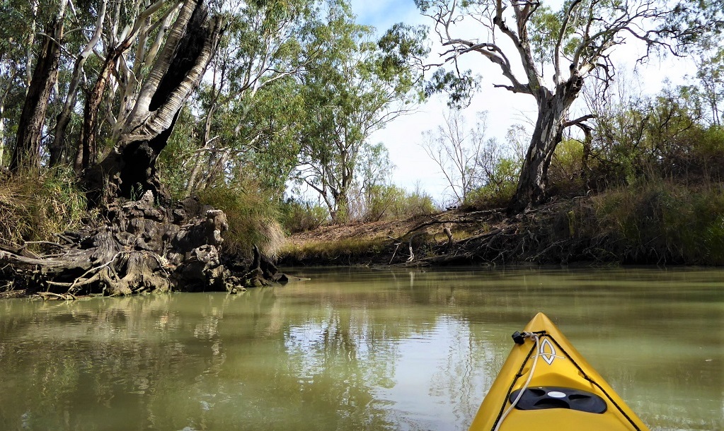
Moorundie Creek runs into Portee Creek past Portee Homestead (this is a BnB).
There are four more portages after Portee Homestead and these occur where tracks/roads cross the creek.
The return trip is upstream (from Swan Reach) via the Murray River.
![]() Note: camping is available at the Reserve at the end of Swan Reach/ Stockwell road beside the Pumphouse, a short distance downstream from where Portee creek enters the Murray on the western side of the river.
Note: camping is available at the Reserve at the end of Swan Reach/ Stockwell road beside the Pumphouse, a short distance downstream from where Portee creek enters the Murray on the western side of the river.
Point B GPS 34.5061 S; 139.5694 E.
No facilities. Bring your own firewood if you plan to have a campfire (observe seasonal fire restrictions)
Blanchetown
The history of Blanchetown grew out of its location on the ‘Sydney Road’ as it was called, for mail contractors and coaches. It was originally surveyed in October 1855 as Blanche Town, named after Lady Blanche MacDonnell, the wife of the Governor of South Australia, Sir Richard MacDonnell. The Governor selected the site personally, to replace an earlier settlement of Murrundi (or Moorundee) – five kilometres downstream – which was subject to flooding.
There had been a ferry crossing at Blanchetown since 1869 (private before 1879, then Government-run). In February 1876 Blanchetown was described as a “small but ambitious settlement, containing a dozen houses, and having a population of about 50 people”. The buildings in the township were “substantially built of a stone quarried in the neighbourhood”.
When land was first sold at Blanche Town it was on the “understanding that a railway should be made there, and some of the allotments consequently fetched as much as £1,200 per acre”. By 1876, however, it was apparent that the railway would by-pass Blanchetown. The railway line connecting Adelaide with the town of Morgan, upstream of Blanchetown, was opened in 1878. This development adversely affected the progress of Blanchetown and resulted in a decline of steamer traffic to the town.
Lock 1 on the Murray River is at Blanchetown. It was the first of the 13 locks and weirs built on the Murray and was completed in 1922. The original purpose was to facilitate navigation for trade along the Murray, but by the time the weirs had been built, trade was declining. The primary purposes now are for recreational boating and to maintain water levels for irrigation. The pool upstream of the weir is 3.6 metres above sea level. It is 274 km from the Murray Mouth.
A bridge was constructed at Blanchetown in 1963. It was the first major prestressed concrete highway bridge in South Australia. In the 1990s it was found to not be structurally sound enough to safely carry B-double trucks. The replacement bridge was completed in November 1998. The old bridge remains in place and can be accessed by foot traffic only.
Portee Homestead
This homestead was built in 1873 in the wetlands on the floodplain for the River Murray and along Portee Creek. The trail passes by this historic homestead. The abundant birdlife that inhabits this slow flowing creek and the beautiful old river gums provide a unique setting.
Edward John Eyre
Eyre was the first big irrigator on the Murray. He was given the role of Protector of the Aborigines and Special Magistrate (in 1841) related to the attacks on overlanders bringing stock from NSW which had people in fear of the black man at that time. He had settled in Moorunde in 1838 and (initially without weapons or troops) brought peace to this section of the Murray. In 1843 there were nearly 400 aborigines in this area however within about 20 years the tribe at Moorunde was extinct.
Eyre built two large dams on the western side of the river at Moorunde to facilitate his irrigation plans (the remains of one wall can be seen near the entrance to Moorunde Creek on this trail). These dams became a casualty of the 1852 flood – called the Gundagai Flood. Eyre returned to England in 1843.
(Information extracted from ‘Murray River Pilot)
